970x125
Hurricane Erin, a Category 2 storm, is creating potentially deadly water conditions all along the US East Coast, the National Hurricane Centre (NHC) has warned.
970x125
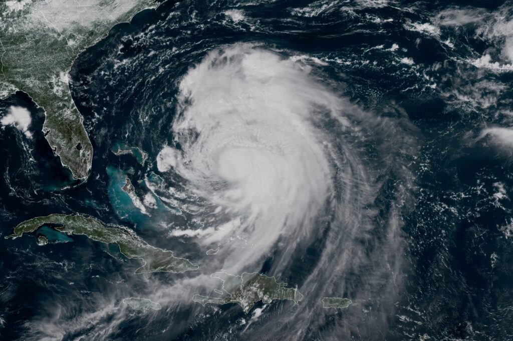
Hurricane Erin is currently northeast of the Bahamas and is forecast to track north and then north-eastward off the East Coast over the next few days, the agency said in its latest update.
According to NHC, while the centre of the storm will remain well offshore, the expanding circulation and outer bands of the storm are expected to bring some impacts to portions of the East Coast, especially along the North Carolina Outer Banks.
An infrared view of #HurricaneErin via @NOAA‘s #GOESEast 🛰️ shows the storm spinning off the East Coast this morning.#TropicalStorm Warnings and #StormSurge Warnings are in effect along coastal North Carolina. #GOES19
Follow #Erin‘s path with our Hurricane Tracker:… https://t.co/xCLzBzcHgF pic.twitter.com/1KVWLfRGWo
— NOAA Satellites (@NOAASatellites) August 20, 2025
It also warned that while Erin lost some strength on Tuesday and dropped to a Category 2 hurricane, it could get stronger again on Thursday before finally weakening by Friday.
Hurricane Erin forces evacuation
Although the weather centre was confident Erin would not make direct landfall in the United States, authorities have warned that water conditions along the East Coast remain dangerous.
It warned beachgoers against swimming due to life-threatening surf and rip currents.
Officials on a few islands along North Carolina’s Outer Banks issued evacuation orders and warned that some roads could be swamped by waves of 4.6 metres. In the Caribbean, heavy rainfall was forecast for parts of the southeast Bahamas and the Turks and Caicos Islands, the weather centre said.
In North Carolina, Governor Josh Stein declared a state of emergency Tuesday in advance of the storm, delegating powers to government officials to mobilise workers and equipment along the coast.
Story continues below this ad
The governor said the storm is expected to bring tropical storm force winds, dangerous waves and rip currents to the state. Tropical storm conditions were expected to begin on Wednesday.
Beaches closed
At least 75 people were rescued from rip currents through Tuesday in Wrightsville Beach, near Wilmington, North Carolina, officials said. Evacuations were ordered on Hatteras Island and Ocracoke Island on the Outer Banks.
New York City closed its beaches to swimming on Wednesday and Thursday, and Governor Kathy Hochul ordered three state beaches on Long Island to prohibit swimming through Thursday. Similar restrictions have been imposed at some beaches in Long Island and New Jersey through Thursday.
Tropical storm watches were issued for Virginia and North Carolina, as well as Bermuda.
Story continues below this ad
“Hurricane Erin, though fairly distant, is bringing with it very dangerous surf and rip current conditions to most of the US East Coast over the next couple of days,” Casey Arthur, Deputy Chief of the Atlantic Beach Fire Department, said.
According to Bob Oravec, the lead National Weather Service forecaster in College Park, Maryland, even if someone thinks they know how to handle a rip current, it’s still not safe in the current conditions. “You can be aware all you want,” he told AP. “It can still be dangerous.”
Erin has become an unusually large and deceptively worrisome storm, with its tropical storm winds stretching 426 kilometres from its core. Forecasters expect it will grow larger in size as it moves through the Atlantic and curls north.
According to scientists, Atlantic hurricanes are now much more likely to rapidly intensify into powerful and catastrophic storms fuelled by warmer oceans.
970x125

