970x125
NASA-ISRO Synthetic Aperture Radar (NISAR), an Earth observation satellite, is scheduled to liftoff at 5:40 PM on July 30 from Sriharikota, Andhra Pradesh. Designed to provide high-resolution data of our planet’s surface, like land and ice, the satellite will showcase how Earth’s topography changes over time and help understand natural disasters like landslides and earthquakes.
970x125
Jointly developed by the Indian Space Research Organisation (ISRO) and the National Aeronautics and Space Administration (NASA), the satellite will be launched on the GSLV-F16 vehicle and has a price tag of $1.5 billion, making it the most expensive Earth observation satellite to date. Ahead of NISAR’s launch, here are five things you need to know about the satellite.
3D detailed view of Earth’s surface
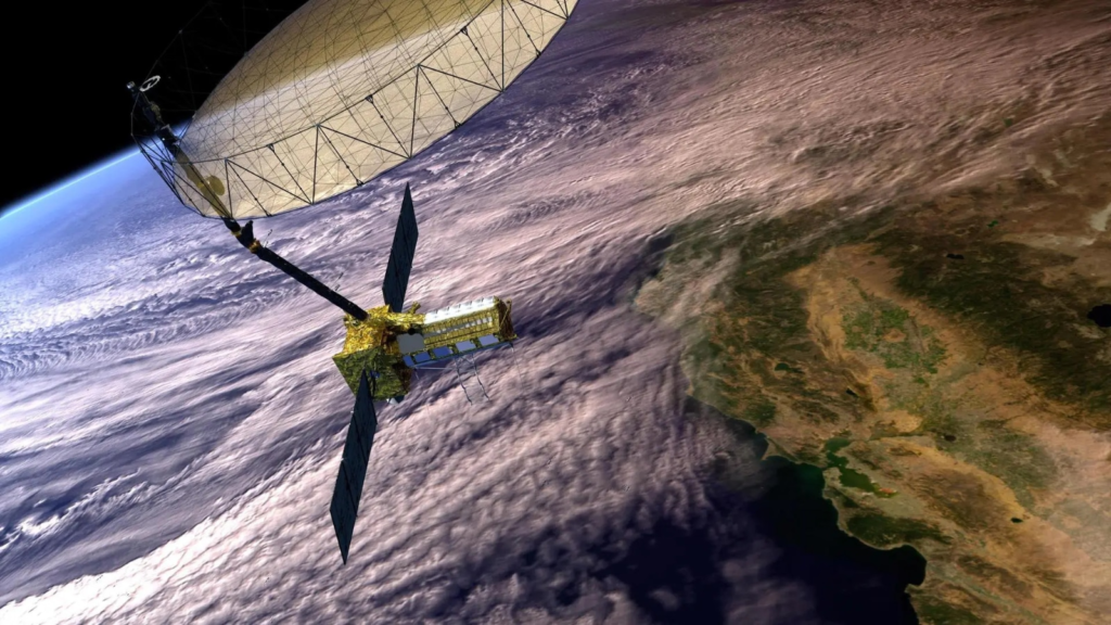
The two synthetic aperture radars, also called SARs, that will be aboard NISAR are designed to detect changes to Earth’s surface down to fractions of an inch. NASA says that the satellite can see through clouds and light rain during both day and nighttime, enabling scientists to continuously monitor natural disasters like earthquakes and landslides. NISAR will also give scientists an “unprecedented coverage of Antarctica” with information about how ice sheets change over time.
Insights into human and natural disasters
Since NISAR will be able to sense minute changes to the Earth’s surface, it will help governments to monitor and prepare for human and natural disasters. Talking of earthquakes, NASA says the satellite will help us identify which parts of a fault could slip or cause earthquakes. As for human-made structures like levees, aqueducts and dams, the data collected by NISAR over time can help detect if the land nearby is weakening key structures in the area and damaging their integrity.
NISAR packs the most advanced radar system
The satellite’s main body has a dual radar payload that consists of an L-band system and an S-band system, with both being sensitive to land and ice surfaces of different sizes. These radar systems can also measure attributes like moisture content, surface roughness, and motion. Every 24 hours, NISAR will be generating roughly 80 terabytes of data. This information will be stored on the cloud and accessible to all.
NISAR will monitor different ecosystems around the world
The satellite’s two radar systems will monitor Earth’s land and ice surfaces twice every 12 days. NISAR will also cover surfaces that haven’t been previously covered by any other observational satellites. While the L-band is capable of penetrating deep forest canopies and offering insights into its structure, the S-band is ideal for monitoring crops. The data from these two radars will help researchers understand how forests, wetlands, permafrost and agricultural areas change over time.
This is the first collaboration between ISRO and NASA
Developed by engineers at ISRO and NASA’s Jet Propulsion Laboratory, the S-band was built at ISRO’s Space Applications Centre in Ahmedabad, while the L-band was built at a NASA facility in Southern California.
Story continues below this ad
These components were then integrated and installed on a modified ISRO I3K spacecraft bus, and the satellite was then transported to the Satish Dhawan Space Centre earlier this year in May. Since then, the satellite’s launch has been delayed several times, with the last launch date pushed back after technical issues with the unfurlable antennae.
970x125

